The understanding of the composition of the subsurface is very often limited. Normally, if a geologic map of the covered geology is available, it is mostly based only on a small number of boreholes. However, since the data density is very limited, geological maps based on such point data like drilling data, have large errors. A geophysical exploration conducted from the ground surface is an effective way to improve the understanding of the hidden geology, and thus to explain the constitution of the underground between the drilling points. Compared to a conventional drilling program a geophysical survey can be accomplished significantly cheaper.
Surface geophysical investigations are generally conducted from the ground surface. Consequently it is not necessary to dig pits in order to gain information about the underground. In a geophysical survey, a physical parameter is measured, for example the electrical resistivity, which can be converted into geological information.
KRIETER WATER & ENVIRONMENT has the ability to use various geophysical methods, depending on the desired exploration depth and on the desired target selected by the study.To select the appropriate method in an investigation area, we consider first the following:
1. Physical properties of the subsurface in the study area
2. Depth interval, in which we expect the desired information
In some cases, we combine two methods to ensure a detailed coverage of the shallow as well as the deep subsurface.
KRIETER WATER & ENVIRONMENT can offer the following geophysical methods:
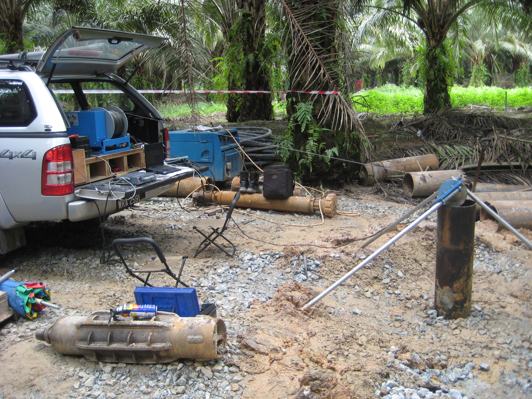
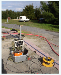
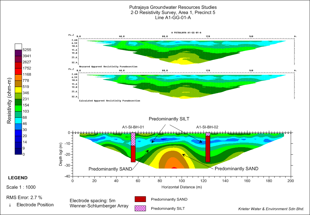
Ground Geophsics (MEP: Multi Electrode Profiling): Electrical resistivity method. Provides high data density. Investigation depth up to 100 m. Productivity 1 km profile length per day.
GroundTEM (transient electromagnetic): Great to map deeper areas of the subsurface up to 200 m. Frequently used for hydrogeological mapping (finding groundwater reservoirs) and mapping of ore in the exploration of mines. 10-20 soundings per day can be made, covering an area of about 2 square kilometers.
SkyTEM: Airborne TEM with similar characteristics, but much higher productivity. Each day about 80 km can be measured with the helicopter profile length. This results in a coverage of 20 square kilometers per day.
FUGRO Frequency method: RESOLVE is a helicopter-borne frequency domain EM system that is designed specifically to locate conductive anomalies and mapping earth resistivities as well as horizontally layered geology, making it an ideal tools for Groundwater exploration and environmental applications.
Seismic Method: which is based on the reflection and refraction respectively of seismic waves. Suitable for exploration of deeper geological layers – up to several hundred meters deep. Shallow seismic investigations can be executed with a towed array with high productivity. Deep seismic investigations require more effort and achieve a productivity of several km per day.
Borehole geophysics: Is performed in wells instead of the ground surface. The geological layer description of boreholes is often limited. A geophysical log can significantly improve the information on the layer properties. We can offer all necessary procedures for the borehole geophysics (resistivity, induction, gamma, caliper, flow-logs, optical televiewer; details see our info-page “Geophysical Well Logging & Physio-Chemical Depth Profiling of Groundwater”).